This is a slideshow photo essay on the history of Sand Point, located on Lake Washington in Northeast Seattle, from settlement in 1855 to the rededication of an expanded Magnuson Park in 2004. Written and Curated by Walt Crowley. Presented by the Seattle Department of Parks and Recreation.
Sand Point: From Mud Lake to Magnuson Park -- a Slideshow Photo Essay
- By Walt Crowley
- Posted 9/27/2004
- HistoryLink.org Essay 7047

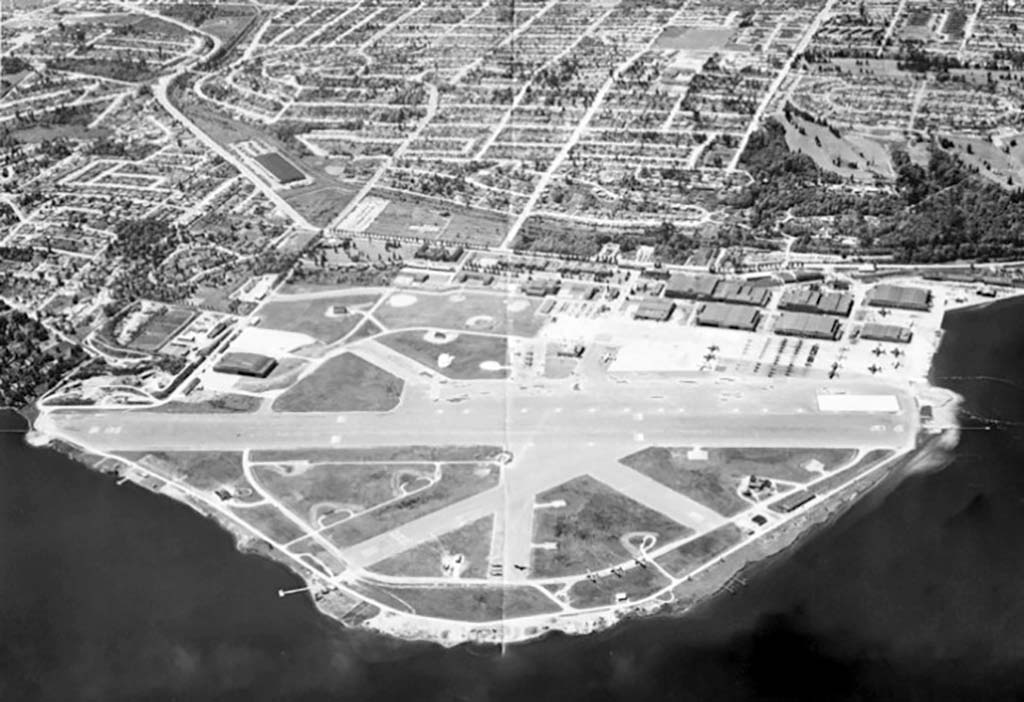
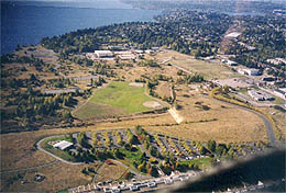
Sand Point is a low-lying peninsula jutting eastward into Lake Washington approximately at NE 70th Street in Seattle. It enjoys a rich history beginning with one of the Seattle area's first detailed surveys in 1855, initial settlement in 1868, development of King County's first true airfield in the 1920s and its later use as a Naval Air Station, and redevelopment as a major park and cultural center since the early 1970s.

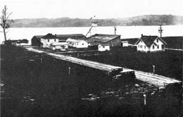
Sand Point was first surveyed by William Stickler in August 1855. He found the peninsula dominated by a large marsh around what was later dubbed "Mud Lake." William Goldmyer staked the first homestead claim to the area in 1868, Edward Lee built a shipyard in 1886, and Morgan Carkeek established a brick and tile mill on the peninsula's northern Pontiac Bay in 1889. Establishment of the Pontiac Post Office in 1890 and a school in 1908 signaled the area's accelerating development well north of the Seattle city limits at the time.

When the Lake Washington Ship Canal opened in 1917, it lowered Lake Washington by eight feet and helped to dry out much of Sand Point's former swampland. At this same moment, pressure was building on local government to provide fledgling pilots and aircraft manufacturers such as William Boeing with a suitable airfield. King County took the lead in 1920 by purchasing much of Sand Point for a landing strip, which it hoped to transfer quickly to the U.S. Army or Navy.

Things did not work out as planned, but the County airfield was the site of many aviation firsts. Foremost, U.S. Army pilots began and ended the first aerial circumnavigation of the globe at Sand Point in 1924.
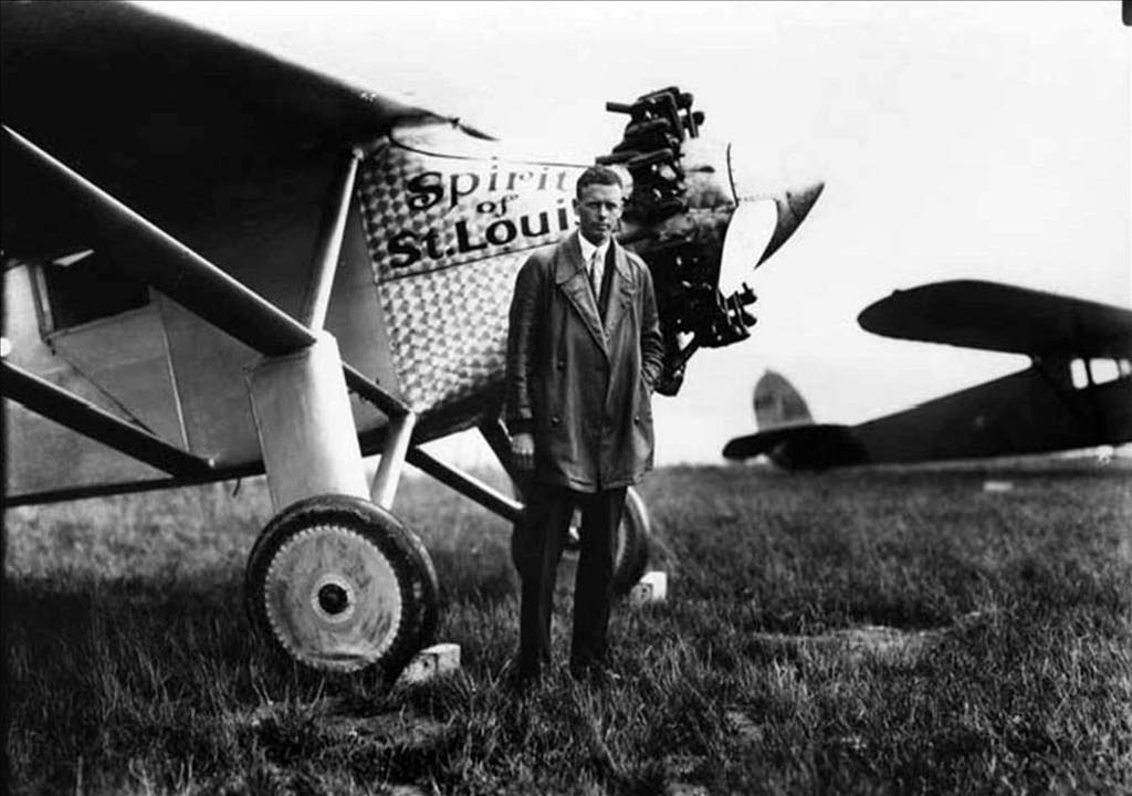
The airfield hosted the region's first air regatta in 1926, and Charles Lindbergh landed at Sand Point in 1927, just months after his historic solo crossing of the Atlantic Ocean.
Despite such milestones, the County lost significant funds operating Sand Point, while an isolationist Congress balked at new military expenditures. Finally, in 1926, the federal government accepted King County's gift of 413 acres at Sand Point, and later appropriated $1 million to begin developing it as a Navy Reserve pilot training center. (With the loss of Sand Point to civil aviation, King County reluctantly developed "Boeing Field," under Boeing's threat of relocation to southern California.)
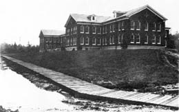
Naval construction at Sand Point began in 1929, and many of the original buildings still stand. Initial development was guided by Lt. Commander J. H. Chapman, and Lt. H. A. Beswick trained the first pilots at the field. He is pictured here giving a ride to Seattle Mayor Bertha K. Landes in 1928.
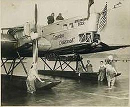
Sand Point hosted an unlikely visitor in 1929 when a giant Soviet seaplane, the ANT-4, landed on October 17 during an around-the-world goodwill tour. Nearly 10 years later, PanAm began operating seaplanes from Matthew's Beach, just north of Sand Point, on Alaskan routes. Plans for an expanded seaplane terminal were aborted by the Japanese attack on Pearl Harbor.
The Sand Point Naval Air Station gained importance during World War II as a base for North Pacific patrols and for training pilots, who would "target" Puget Sound ferries to hone their dive-bombing skills. Following World War II, Sand Point aircraft routinely scanned the Pacific for Soviet submarines and other intruders. The base's interracial complement included the "Jive Bombers," who later formed The Question Marks jazz band.
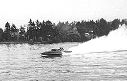
Naval history of a different sort was made in 1950, when the revolutionary hydroplane Slo-Mo-Shun IV set a world speed record just offshore from Sand Point. One half century later, the Miss Freei broke the world's speed record for a propeller-driven boat on the same course.
The Cold War's gradual thaw and mounting federal deficits ultimately rendered Sand Point obsolete as military installation. The Navy deactivated the base in 1970 and offered the City of Seattle nearly 200 acres along Lake Washington (a northern parcel was transferred to the National Oceanographic and Atmospheric Administration, and the Navy retained the rest).
The gift triggered a political struggle between advocates of park development, led by Mayor Wes Uhlman and Seattle City Council Member Jeanette Williams, and local pilots who wanted to convert Sand Point's airfields and hangars to civilian use. The latter prevailed in non-binding referendum in 1974, but Seattle voters resoundingly endorsed a park plan later in the year. The new park was named in 1977 for U.S. Senator Warren G. Magnuson, who helped to secure federal aid.
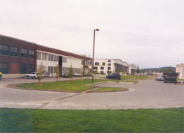
In 1991, the Navy announced its intention to surplus the rest of Sand Point. This triggered a new round of competing claims by the Muckleshoot Tribe, Seattle Public Schools, City of Seattle, and other jurisdictions. Seattle ultimately won the Navy's nod on December 12, 1997, with a comprehensive plan for recreation, arts, and housing uses. In 1999, the City acquired the Sand Point Historic District, including the buildings originally constructed by the U.S. Navy.

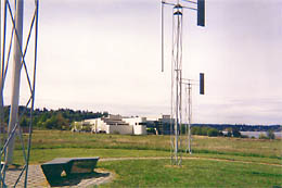
Under a revised 1999 "Blue Ribbon" plan, Sand Point hosts art studios and performance spaces, low-income and University of Washington housing, community agency offices, play fields, dog runs, and restored wetlands and natural habitats as part of an expanded Magnuson Park.
On September 20, 2004, Seattle Mayor Greg Nickels presided over a ceremony to rededicate Magnuson Park as expanded to include the entire Sand Point Historic District. The ceremony recognized the expansion and the naming of the entire enlarged park after the late Senator Warren G. Magnuson. Ultimately, much of Sand Point might not look all that different from the area William Stickler surveyed nearly one and one half centuries ago.
Licensing: This essay is licensed under a Creative Commons license that encourages reproduction with attribution. Credit should be given to both HistoryLink.org and to the author, and sources must be included with any reproduction. Click the icon for more info. Please note that this Creative Commons license applies to text only, and not to images. For more information regarding individual photos or images, please contact the source noted in the image credit.
