This is a 10-minute slideshow of the history of Seattle. Written and Curated by Paul Dorpat.
Seattle's History -- A 10-Minute Slideshow
- By Paul Dorpat
- Posted 1/01/1999
- HistoryLink.org Essay 7085

An obelisk commemorates the site at Alki Point, in present-day West Seattle, where in the fall of 1851 the Denny Party, led by Arthur Denny, first came ashore.
Less than one year later most of these Midwestern settlers moved from the Point and its exposed location on Elliott Bay to the protected eastern shore, the site of the future Seattle.
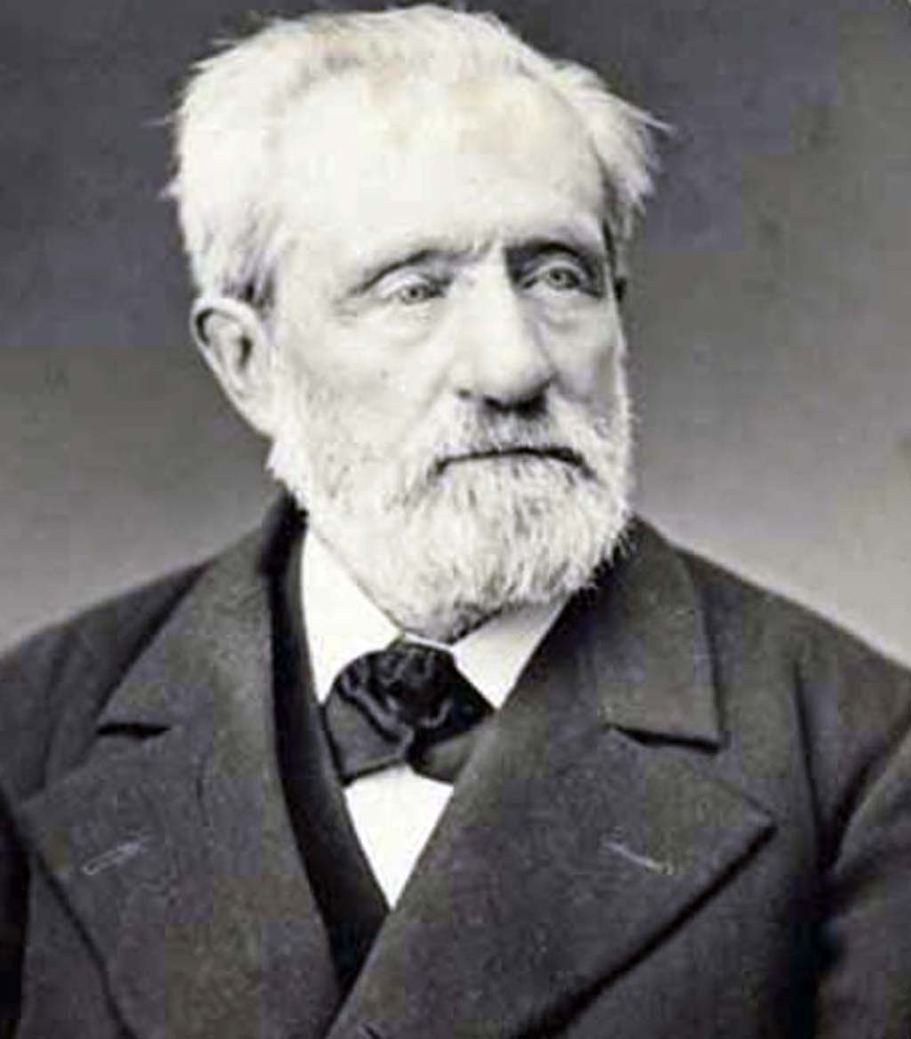
That spring, their hopes of building a prosperous community was aided mightily with the arrival of Henry Yesler, who established a steam sawmill.
Yesler's wife Sarah arrived from Ohio in 1858, and became a vital contributor to the new community. Here Sarah Yesler poses in 1859 on the front porch of their Pioneer Square home in the oldest surviving photograph of any part of Seattle.
Henry Yesler's sawmill, the first steam powered mill on Puget Sound, was for years the economic mainstay of the platted and proud but still unincorporated village.
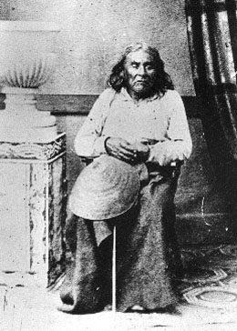
The settlers named their community for Chief Seattle, the helpful Indian leader who in 1864 posed for Seattle's first resident photographer, E. M. Sammis.
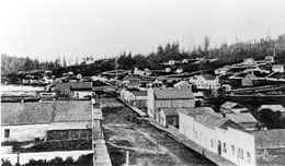
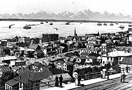
Another of the photographer's surviving classics is this 1865 panorama of the then 14-year-old community.
The University of Washington was founded in 1861, and at first located in downtown Seattle. However, Asa Mercer, the first president of the school, is better remembered for his ...
"Mercer Girls": the entourage of single women he brought from New York to civilize the Wild West and also, it was hoped, find suitable husbands in Seattle. Many became teachers, one became a school superintendent, another, along with her father, a lighthouse keeper. They helped to found some of Seattle's oldest families.
By the late 1870s, coal from the eastside of Lake Washington had supplanted lumber as Seattle's principal export. The King Street Coal Wharf was the largest structure in town.
With a few more than 3,000 citizens, Seattle in 1880 was the second largest town in Washington Territory -- after Walla Walla. A sustained building boom followed and increased Seattle's population to more than 230,000 within 30 years.
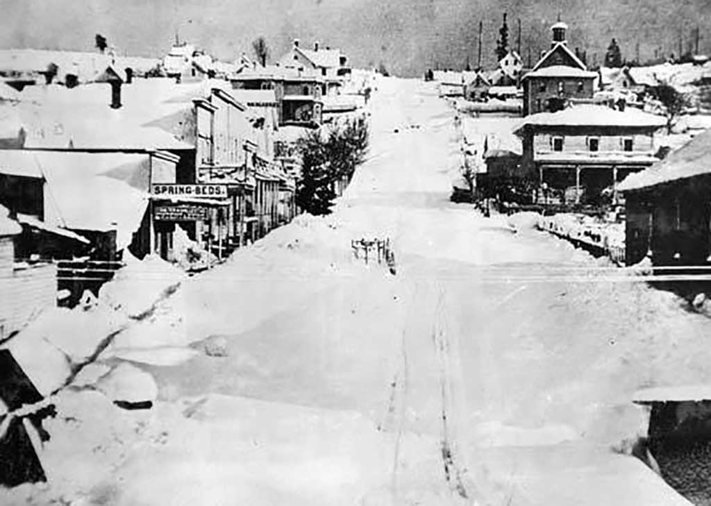
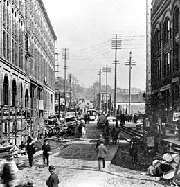
As evidence of the growth of a city, this record of the Big Snow of 1880 looks east on Cherry Street from Pioneer Square and can be compared with the second view, photographed from the same site in 1912.
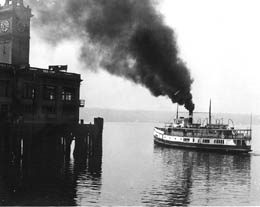
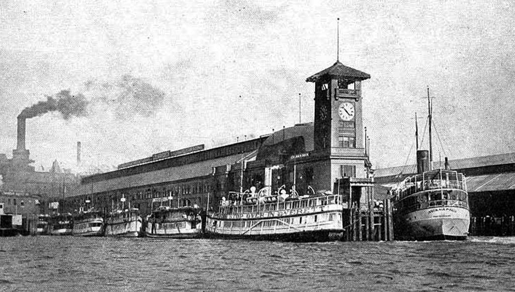
The Seattle story owed a good part of its success to its role as homeport for most of Puget Sound's "Mosquito Fleet" steamers.
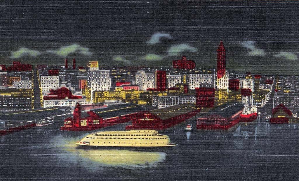
Later, auto ferries pushed aside the small steamers, and the "World's First Streamlined Ferry," the Seattle-based Kalakala, became the international symbol of Puget Sound.
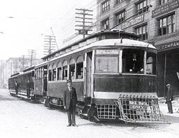
The 1884 introduction of horse trolleys inaugurated a system of franchised private street railways that was ...
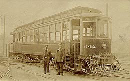
soon electrified. The city purchased the system in 1919.
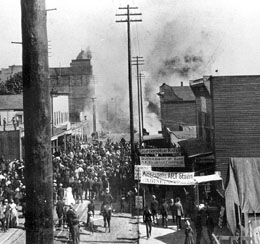
The "Great Fire" of June 6, 1889 reduced the firetrap business district to ruins ...
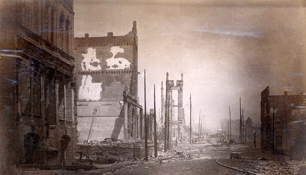
and destroyed more than 30 city blocks.
While it still smoldered, Seattle promoted itself as a "phoenix" that would quickly rise from its own ashes. One hundred and thirty new brick structures were built by the end of the year ...
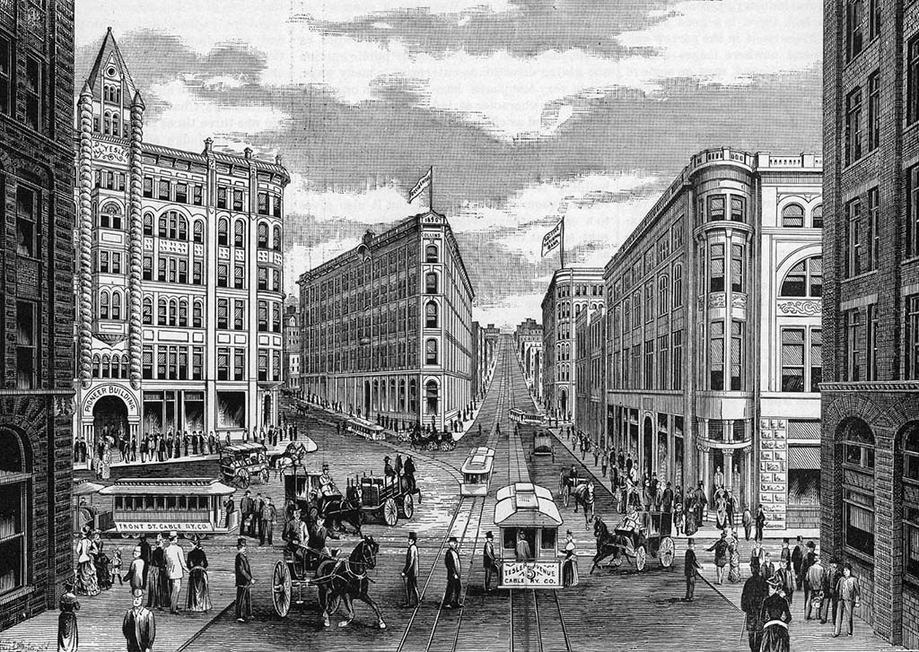
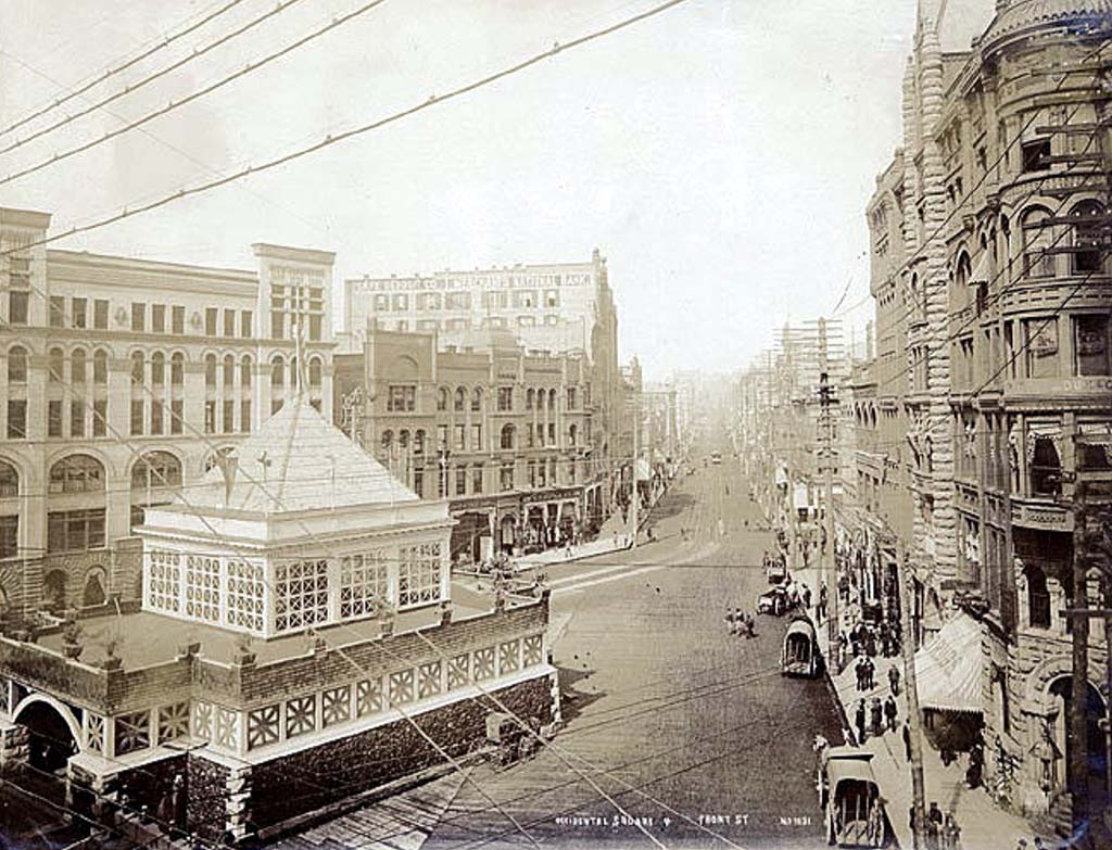
many of them in what is now the landmark Pioneer Square Historic District.
Following the Great Fire, cable and electric interurbans were extended to Seattle's many new suburbs.
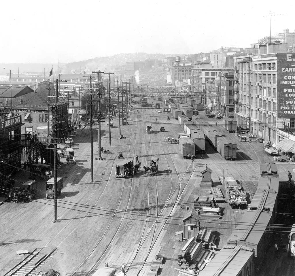
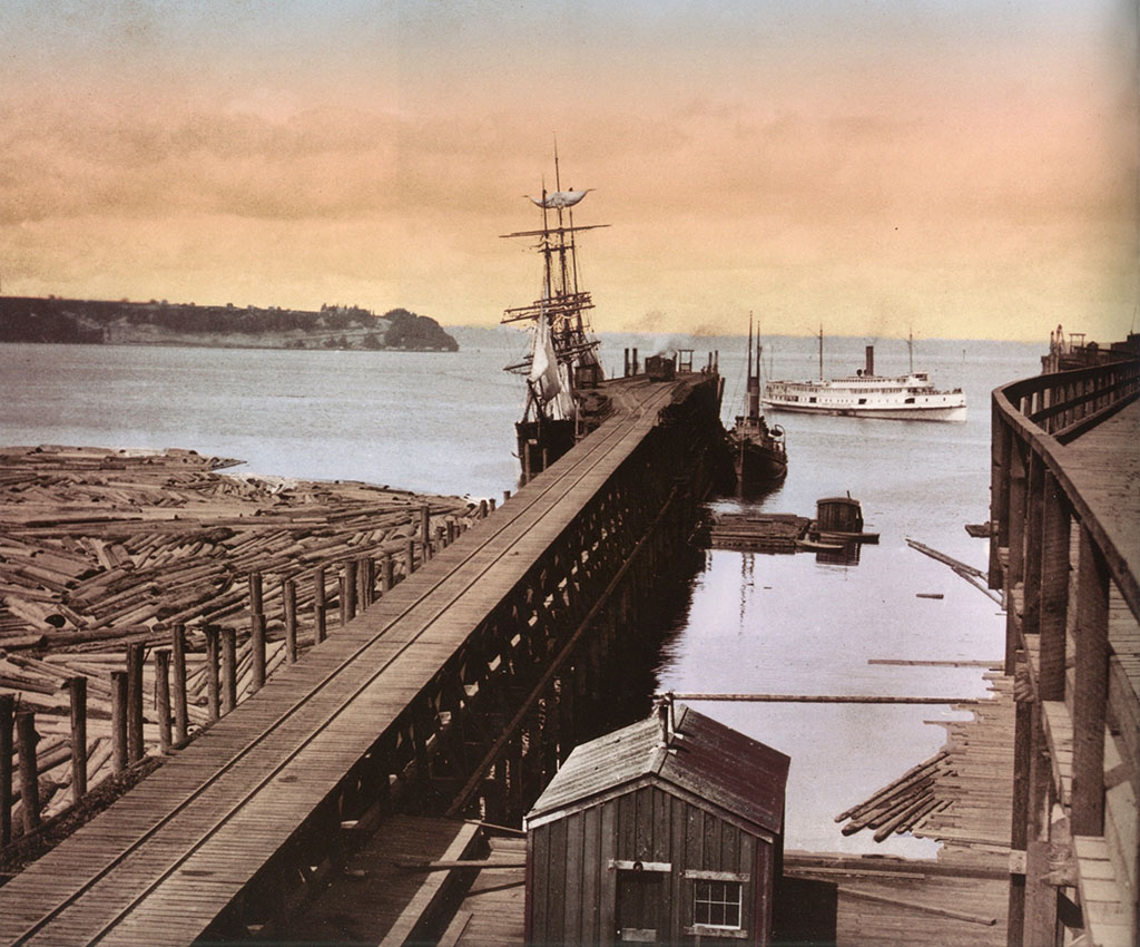
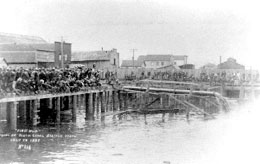
On the waterfront, Railroad Avenue was quickly extended from the shoreline on a timber trestle supporting nine parallel tracks above the tides.
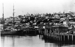
In 1893, the transcontinental Great Northern Railway reached Seattle, but so did the great economic panic of that year.
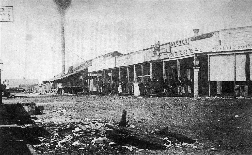
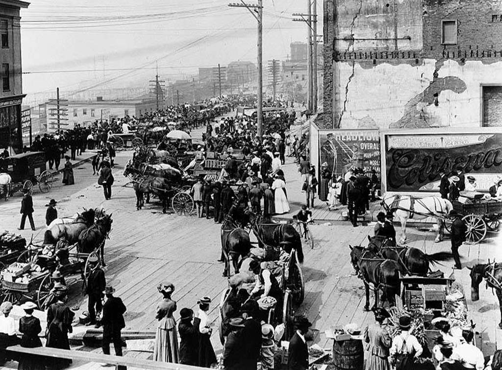
The first picture shows Pioneer Square in 1893.
The second shows the Great Northern docks at Smith Cove in 1900.
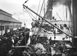
The dull times that followed were at last discarded with the beginning of the Klondike Gold Rush in 1897. Gold was discovered in the Klondike River Valley in Canada, and the rush to Alaska and from there to the gold fields was on.
Seattle was the principal outfitter for the thousands of "traveling men" heading for the gold fields on the Klondike.
On their return the city shared in the wealth of the lucky few that struck it rich.
In 1895, the work of filling the tidelands south of King Street began in earnest when earth dredged for the deepening of the Duwamish Waterway was dumped into the tidelands. Eighty years later King County built its Kingdome on this reclaimed tideflat.
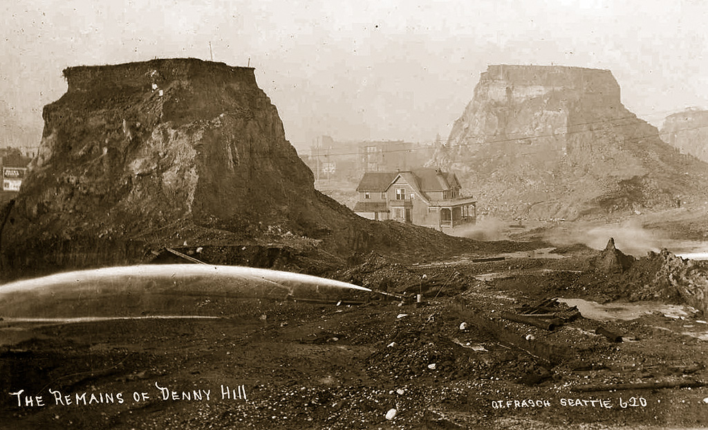
The razing of Denny Hill at the north end of the business district began in 1898 and continued (with pauses) for 30 years as more than 60 city blocks were regraded.
The perennial job of reclamation was extended in 1907 with dirt flushed from the nearby King and Jackson Street regrades.
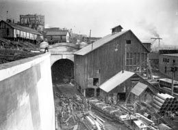
The 1904 construction of the railroad tunnel beneath the city also allowed the scrapings of Denny Hill to be easily carried to the tidelands and dumped there.
Early promoters of the "Queen City" described it as built, like Rome, on Seven Hills. The real number of hills is many more.
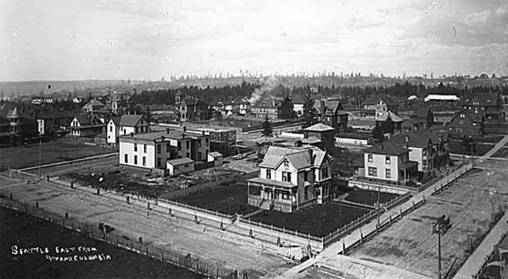
First Hill, directly behind the pioneer business district, developed into Seattle's first exclusively residential neighborhood.
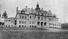
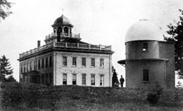
The University of Washington moved to its new campus on the north shore of Lake Union's Portage Bay in 1895 ...
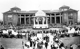
but it was the makeover of the campus for the 1909 summer-long Alaska-Yukon-Pacific Exposition -- A-Y-P for short -- that endowed the modern campus with a landscape designed by the Olmsted Bros.
The A-Y-P was a celebration of Seattle's link to Alaska and of hopes for the Pacific Rim. The popular Boston-based Olmsteds were also the primary designers of the boulevards that link many of Seattle's parks.
The Smith Tower was dedicated in 1914 and more than doubled the height of the city's skyline.
The skyline's 42 stories were nearly doubled again in 1985 with the completion of the 76 story Columbia Center.
In 1916, Bill Boeing personally tested the "B&W," his company's first plane, from a hangar on Lake Union.
In 1911, Seattle voters established the Port of Seattle to manage the waterfront. In 1917, the Seattle waterfront was, after New York City, the busiest port in the nation.
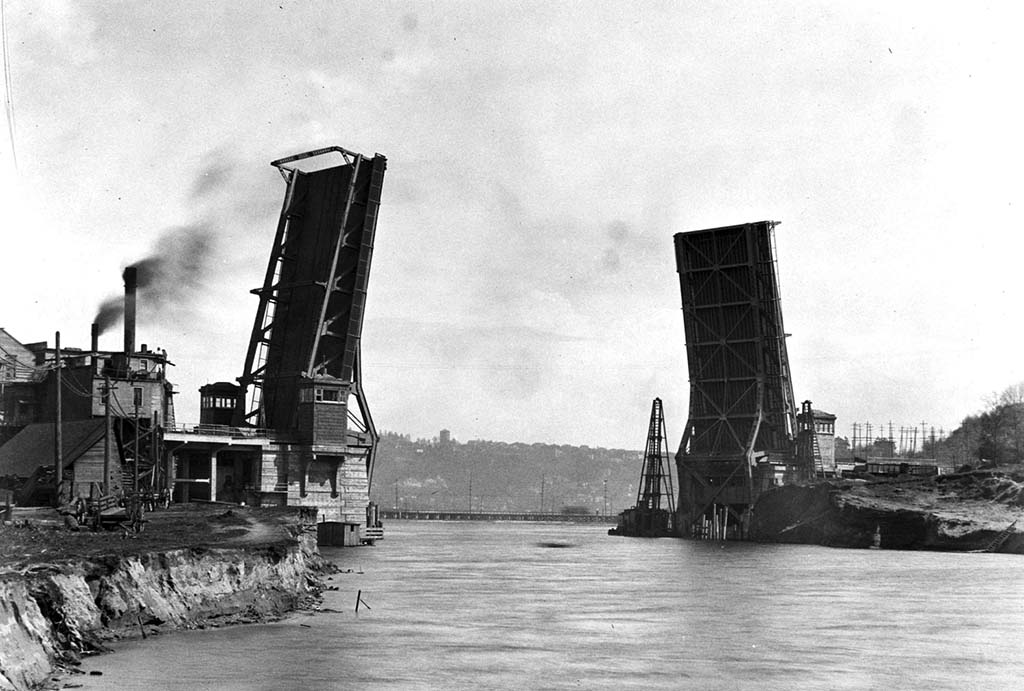
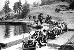
The formal opening of the Lake Washington Ship Canal -- also in 1917 -- fulfilled a pioneer dream of linking Puget Sound with a fresh water harbor.
The canal required the construction of new lift bridges including this span at Fremont, one of the busiest bascule bridges in the world.
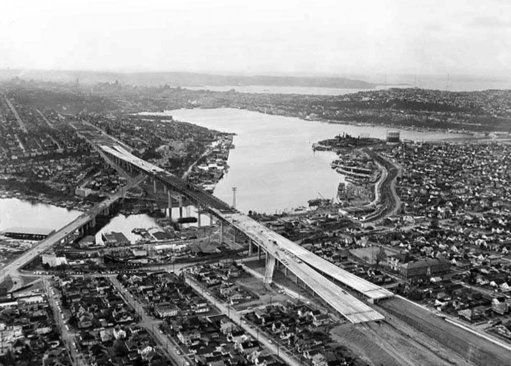
Higher spans over the canal were added in 1932 for Pacific Highway 99, and in 1962 for Interstate-5 freeway. The age of the automobile had arrived...
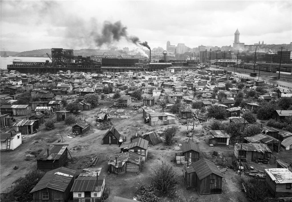
but so had the Great Depression. South of Pioneer Square, a shantytown of the unemployed grew up. Residents called it "Hooverville" after the president they faulted for not confronting the economic disaster.
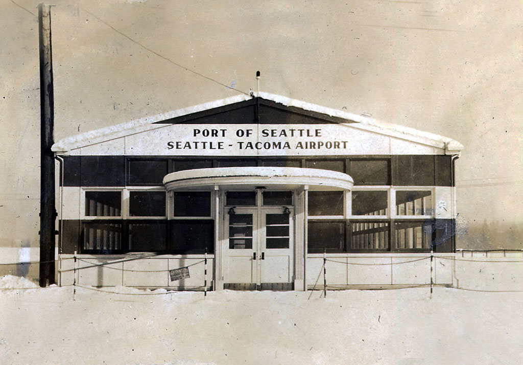
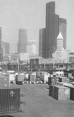
During the war, Port of Seattle built the Seattle-Tacoma International Airport (Sea-Tac Airport). Later the Port modernized the Seattle waterfront into a world-class cargo port based on container technology.
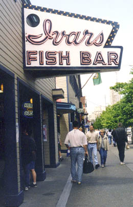
Today Seattle's waterfront welcomes tourists from all over the world. The city is a major port, home to enterprises like Starbucks and Adobe, and a center of theater, film, and the visual arts. It is also a gateway to nearby mountains and islands.
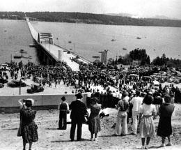
The 1940 dedication of the Lake Washington Floating Bridge (later renamed the Lacey V. Murrow Bridge) opened the Eastside of Lake Washington, first for Seattle bedrooms, and following World War II for the booming growth of Bellevue and, most recently, Redmond, the home of the main campus for Microsoft Corporation.
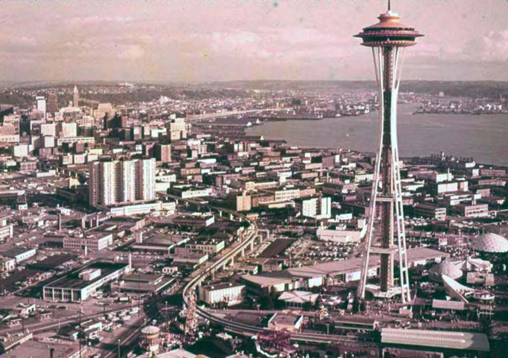
Since its 1962 construction for Century 21, Seattle's World's Fair, the Space Needle has become Seattle's international symbol.
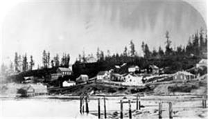
In sum, the growth of the pioneer outpost recorded in this 1869 photograph was such that in only 130 years Seattle became the Pacific Northwest's cosmopolitan center.
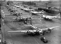
World War II brought economic recovery and a surge of new residents as workers came to build airplanes and ships at Boeing and elsewhere. Shown are B-17 Flying Fortress bombers at Boeing Field.
For many Seattleites, the heart of their city is the Pike Place Public Market, founded in 1907 and saved by vote from urban renewal in the early 1970s.
Sources:
Written and Curated by Paul Dorpat.
Licensing: This essay is licensed under a Creative Commons license that encourages reproduction with attribution. Credit should be given to both HistoryLink.org and to the author, and sources must be included with any reproduction. Click the icon for more info. Please note that this Creative Commons license applies to text only, and not to images. For more information regarding individual photos or images, please contact the source noted in the image credit.
