This is Part 2 of a three-part slideshow photo essay on the history of the Seattle Aquarium and its neighborhood beginning in 1841 through the present day. Part 2 takes the story from the Great Seattle Fire of 1889 to the Great Depression of the 1930s. Curated by Paul Dorpat. Edited by Walt Crowley. Presented by the Seattle Aquarium Society.
Seattle Aquarium Slideshow, Part 2: From the Great Fire to the Great Depression, 1889-1930s
- Posted 1/22/2005
- HistoryLink.org Essay 7164
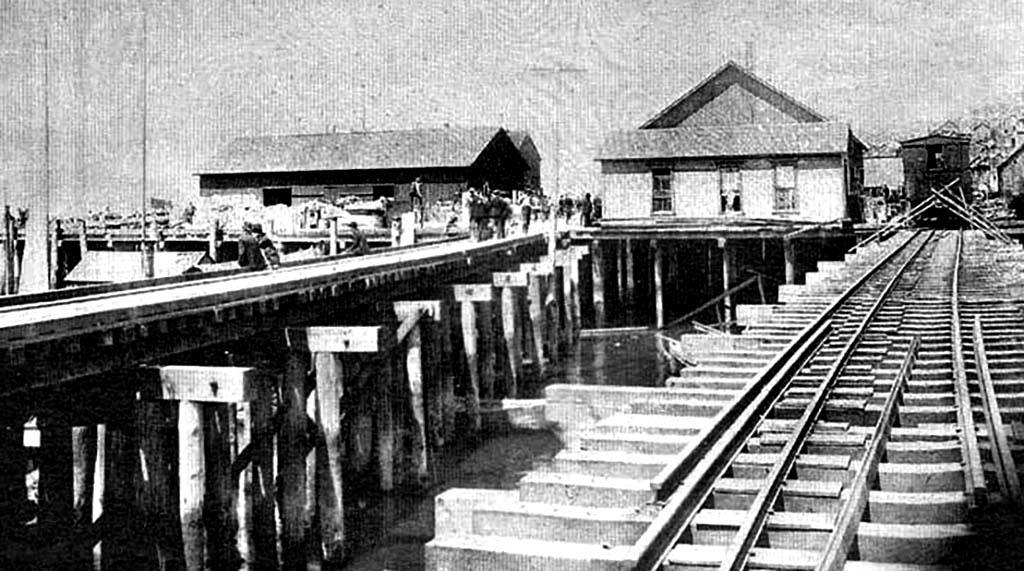
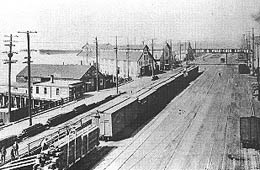
After Seattle's Great Fire burned the waterfront in June 1889, the railroad trestles were quickly rebuilt, as shown in this view from summer 1889. The pictured structures stand on the 1888 wharf of Schwabacher & Co., roughly where Pier 58 stands today, and barely escaped the Great Fire. The gaps between the two railroad trestles would soon be planked in to create "Railroad Avenue" and then Alaskan Way, as later views will show.
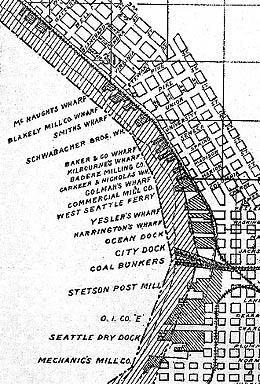
This detail from an 1890 map by the State Harbor Line Commission shows the central waterfront's rapid post-fire redevelopment. Docks and wharves were not yet uniformly numbered (and the present system would not be adopted until 1944).
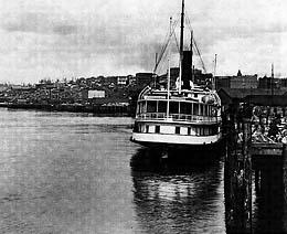
A Northern Pacific Railroad photographer standing on the Main Street dock caught this view of the northern waterfront and a nearby "Mosquito Fleet" steamer. The northern waterfront is still largely undeveloped.
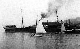
Seattle celebrated the arrival of its second transcontinental railroad, the Great Northern, in 1893, and was then sucked under by a deep national economic depression. Local spirits lifted briefly on August 31, 1896, when the Miike Maru inaugurated direct shipping with Japan. The freighter moored at Schwabacher's Wharf, near the foot of Union Street.
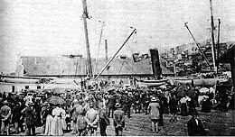
Seattle's recovery began in earnest on July 17, 1897, when the steamship Portland tied up at Schwabacher's with a "ton of gold" wrested from the Klondike. Throngs turned out to view the ship, which is barely visible here because of low tide, not the weight of her precious cargo.
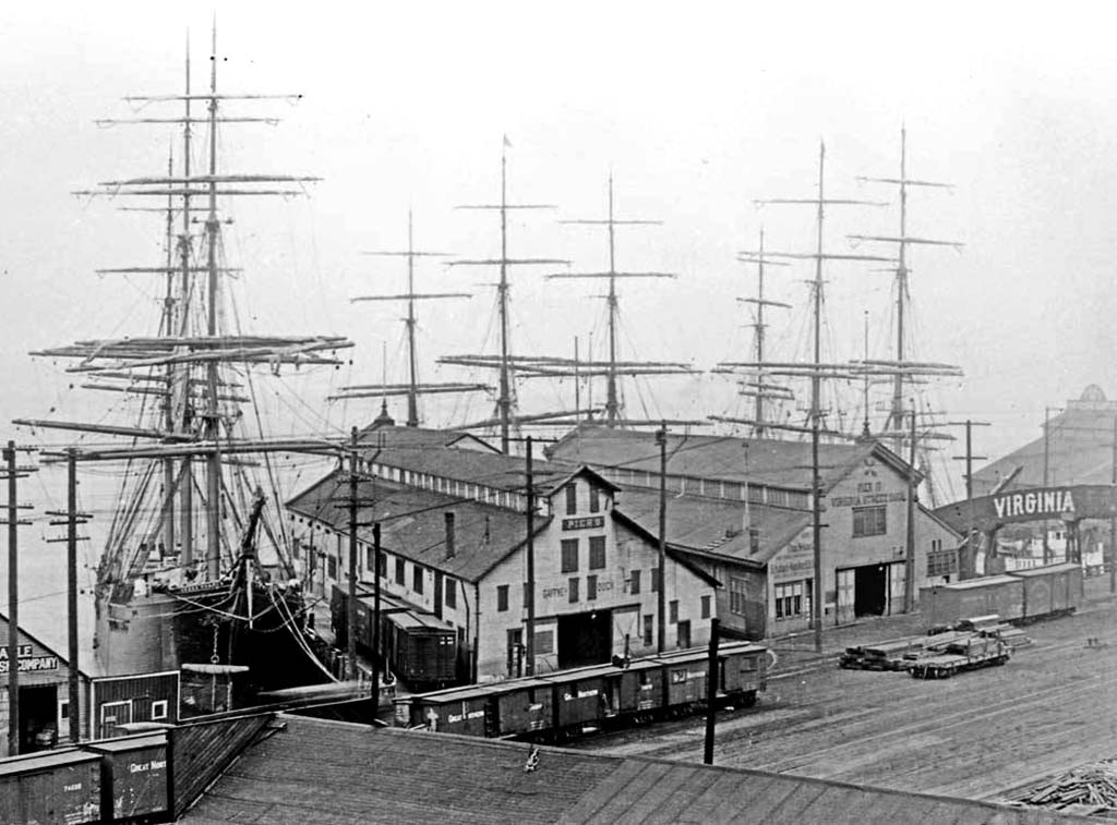
Klondike gold fueled new construction on and beyond the waterfront, including an expansion of Schwabacher's Wharf and construction of the nearby Diamond Ice Company across the new Railroad Avenue. This photo was taken by Alders Wilse from the roof of the Seattle Fish Co. Wharf (on the present site of the Seattle Aquarium) in 1898. This wharf was built and operated by Ainsworth & Dunn, who later shifted to Pier 70.
Wilse also snapped this slightly later view of the area, showing an enlarged Schwabacher's pier shed and its northern neighbor, the Seattle Fish Co. Wharf. The foreground ramp ran above University Street to link the waterfront with upper blocks.
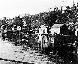
The Klondike Gold Rush also attracted many transients (and bankrupted many prospectors) who found refuge in shanties and cheap houses along the shoreline. Virginia Street dead ends on the left of this view looking east to Belltown from Railroad Avenue.

The vacant Washington (Denny) Hotel looms over the Schwabacher wharf and central waterfront from its perch atop Denny Hill. Started in 1890, the hotel did not welcome its first guest -- President Teddy Roosevelt -- until 1903 (and was razed in 1906 as part of the Denny Regrade). This view, taken about 1900, shows a jumble of small piers spreading north from Schwabacher's. They probably sprang up to help service people and ships drawn to Seattle by the Klondike Gold Rush, which also made Schwabacher's very wealthy.

Judging from the large flotilla on the Bay, this rare view probably records President T.R. Roosevelt's arrival in Seattle in May 1903. The new Gaffney Dock at the foot of Pine Street stands in the center and a long pier juts out from Seattle Fish Co. Wharf on the left. The smaller, unnamed pier and shed between them stand in the space now occupied by the Seattle Aquarium's main structure on former Piers 60/61. They first appeared in photos taken ca. 1900.

City Engineer R. H. Thomson had begun expanding Railroad Avenue when this 1902 view was captured. He despised the dangerous, congested strip and urged the Northern Pacific and Great Northern railroads to tunnel under downtown in order to reduce waterfront traffic. He got his wish in 1903, when work began on the downtown railroad tunnel (completed two years later).
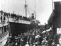
In 1904, Ainsworth & Dunn replaced their Seattle Fish Co. dock with a new, larger pier, dubbed the Pike Street Wharf and numbered 8 at the time. Now Pier 59, the wharf served the W. W. Robinson Hay & Grain Co. and various steamship lines. It and the neighboring Schwabacher's Wharf, were busy during the "second" Klondike Gold Rush of 1904, as evidenced by the this crush of passengers and bystanders meeting the S.S. Ohio from Nome, Alaska.

In 1903, The San Juan Fish Co. occupied a small dock between the Pike St. Dock and Gaffney Dock (on the Aquarium's present site). The company's two large halibut boats are moored here, while the veteran Mosquito Fleet sidewheeler George E. Starr lies off the Gaffney Dock to the north.
The Virginia Street Dock was built immediately north of the Gaffney Dock in 1906. It included the amenity of an overpass to connect the dock with its owner's warehouse on the east side of Railroad Avenue. This second photo also shows why the deterioration of Railroad Ave. was becoming a public issue.
Many plans would be hatched to clean up the waterfront. Virgil Bogue, who had helped to design Tacoma's harbor facilities, was retained in 1910 to draft a comprehensive plan for Seattle. He joined R. H. Thomson (who penned the pictured plan) proposing a public park, boat moorage, and ceremonial "watergate" near the foot of Pike Street, but voters rejected his Plan of Seattle in 1912. Meanwhile, in September 1911, citizens overcame the bitter opposition of railroads and created the Port of Seattle to bring order and improvement to the waterfront.
This 1910 view shows Belltown from the water. The three-fingered trestle on the left was built over Bell Street to convey soil from the Denny Regrade to Elliott Bay. Also note the new Volunteer Park water tower on the horizon. The second view is two years older, and shows the Pike Place Public Market's new Main Arcade and the trestle linking it to the waterfront.
By 1912, the San Juan Fish Co. had moved to the Duwamish East Waterway. It was succeeded by the Reliable Oyster & Fish Co. and a small cafe, and then by the Ocean Fish Co., on the future site of the Seattle Aquarium.
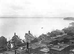
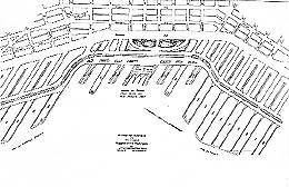
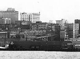
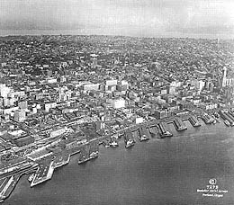
The Smith Tower gave urban photographers a dramatic new perspective starting in 1914. This early view shows most of the central waterfront from the towers of the Colman Dock ferry landing and Grand Trunk Pacific terminal (which burned soon after this picture was taken) in the lower left north to today's Pier 70. The map below shows that the Whiz Fish Co. and a municipal boat moorage now occupy the future home of the Aquarium.
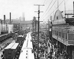
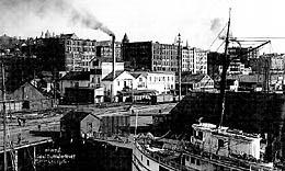
The sidewalk in front of today's Pier 59 is crowded with friends and relatives of enlistees and troops aboard a long troop train in this undated view during World War I. During the "Great War," federal overseers took charge of the waterfront and coordinated shipbuilding and maritime commerce in Seattle. Note that Pacific Net & Twine Co. has succeeded the hay and grain traders as the pier's tenant.
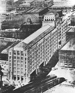
In 1924, Seattle's flamboyant dentist-mayor "Doc" Edwin Brown floated this grand scheme (sketched by architect John Graham Sr.) to "clean up" Pike Place Market and link 1st Avenue and the Market at Pike Street. Nothing came of it, and Bertha K. Landes unseated the mayor two years later.
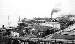
In the center of this 1926 aerial view and lower detail, the new Arden Salt Dock appears nudged up against the older Whiz Fish Co. wharf. Under direction of the Port Commission (part of whose new Bell Street terminal shows in the lower left corner), new piers were built to specified angles to the shoreline. In the left corner of the upper view, the new dog-legged Lenora Street Dock (Piers 64 & 65), has replaced the older Pacific Coast Company's Orient quay just north of the Virginia and Gaffney Docks.

Three years later, in this 1929 aerial, the old Whiz Fish wharf has been rebuilt and joined to the salt dock (later numbered Piers 60 & 61). Note the overpass leading from the Pike Place Market to the future home of the Aquarium.
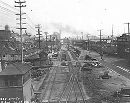
The deplorable state of Railroad Avenue is manifest in this early 1930s view looking south from the Lenora Street overpass, shown in the lower photo. The castle-like building on the bluff is the former Armory, which was demolished in the mid-1960s.
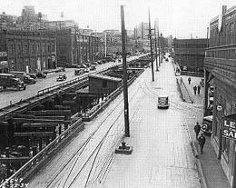
Fed-up local officials used new, Depression-era federal funds to launch Railroad Avenue's replacement in 1934. They began by building a seawall to contain the fill that would ultimately support Alaskan Way. The lower photograph documents the work's progress between 1934 and 1936 as seen from the Lenora Street overpass.
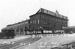
Federal WPA funds also paid for photographic survey of virtually every structure in King County between 1938 and early 1940. We'll end Part 2 of this Slide Show with a portfolio of today's Piers 57 through 65 as they appeared on the eve of World War II. We begin with land and water views of old Pier 6 (modern 57), which was occupied by the Milwaukee Road and is now part of Waterfront Park.
The lower view shows the former Schwabacher Wharf, Pier 7 (58). It was modified for pleasure craft in 1952 and later demolished. The gap is now occupied by Waterfront Park.
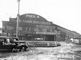
Pier 8 (59), the former Pike Street Dock, was occupied by Pacific Marine Supply Co., and now houses the Omnidome and part of the Seattle Aquarium.

Modern Pier numbers 60 & 61 housed the Arden Salt Dock and Whiz Fish Co. where the Seattle Aquarium currently stands.

Piers 9 (62) and 10 (63) were better known as the Gaffney and Virginia Street Docks. The pier sheds were demolished in the 1980s to create a platform now used for summer concerts.

The Port of Seattle's Piers 11-A (64) and 11-B (65) housed the Seattle terminal for Canadian Pacific Railway's steamships and the Leslie Salt Company, which were linked with the uplands by the Lenora Street overpass. The piers were demolished in the 1990s to make room for a new quay and marina as part of the Port's Bell Street Harbor project.
Continued in Part 3.
Licensing: This essay is licensed under a Creative Commons license that encourages reproduction with attribution. Credit should be given to both HistoryLink.org and to the author, and sources must be included with any reproduction. Click the icon for more info. Please note that this Creative Commons license applies to text only, and not to images. For more information regarding individual photos or images, please contact the source noted in the image credit.
